This is what usually what comes to mind, especially to Coloradans, and is an example of ONE of the divides!
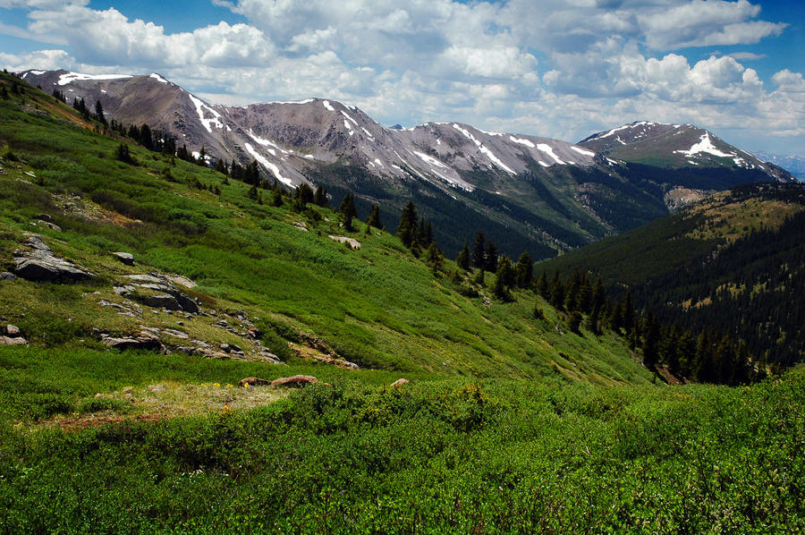
And the picture above is typical of the North-South Continental Divide from the Canadian border with Montana to the Mexican border with New Mexico as shown below:
However, what is shown is the Great North-South Continental Divide, if you have ever driven from Goshen to the South Bend Airport, along the US 20/31 Bypass you should have noted this sign:
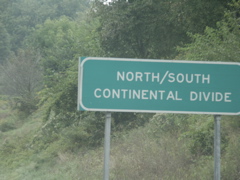
It's on a very small ridge as shown here:

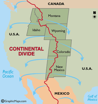
However, all of the Divides in the US are shown below:

So, you will have to give yourself your own grade as to how well you answered the question :-) There are a couple of interesting things to note about the US Great Continental Divide. Look closely at Wyoming and the very southern portion in New Mexico and Mexico - The Great Divide divides! This creates a basin that does not drain east or west, much like the Great Basin shown in Nevada and some adjacent areas - think Death Valley. I think that I have traversed all of the US Divides.
No comments:
Post a Comment